Every city has its unique natural conditions and resources shaped by its geographical location and various factors that influence the lives of its residents. Today, let’s explore this topic in the context of Toronto. More on toronto.name.
Toronto’s advantageous geographical location
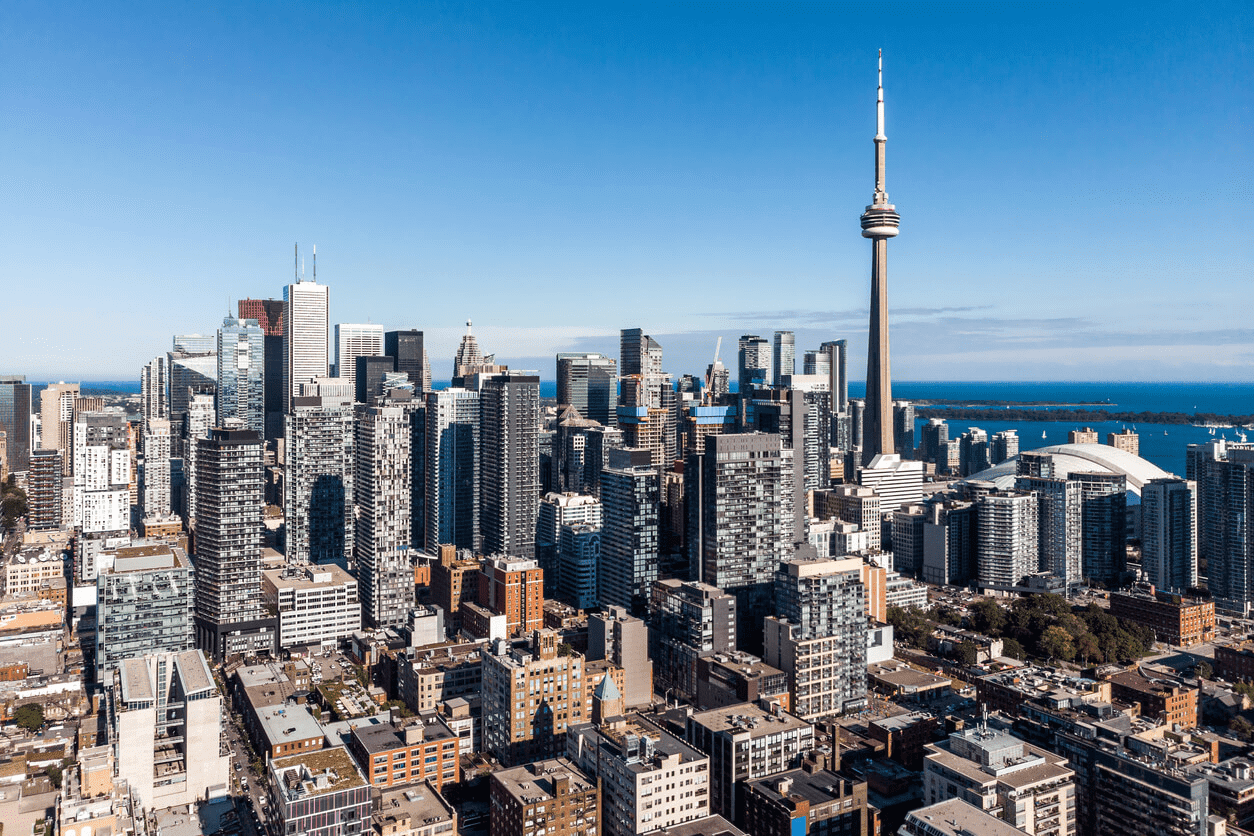
Toronto is Canada’s most populous city, recognized as a multicultural, financial, and commercial hub of the country. Its location on the northwestern shore of Lake Ontario—part of the border between Canada and the United States—provides access to Atlantic shipping routes via the St. Lawrence Seaway and major U.S. industrial centres through the Great Lakes. These advantages have established Toronto as a key international trade centre.
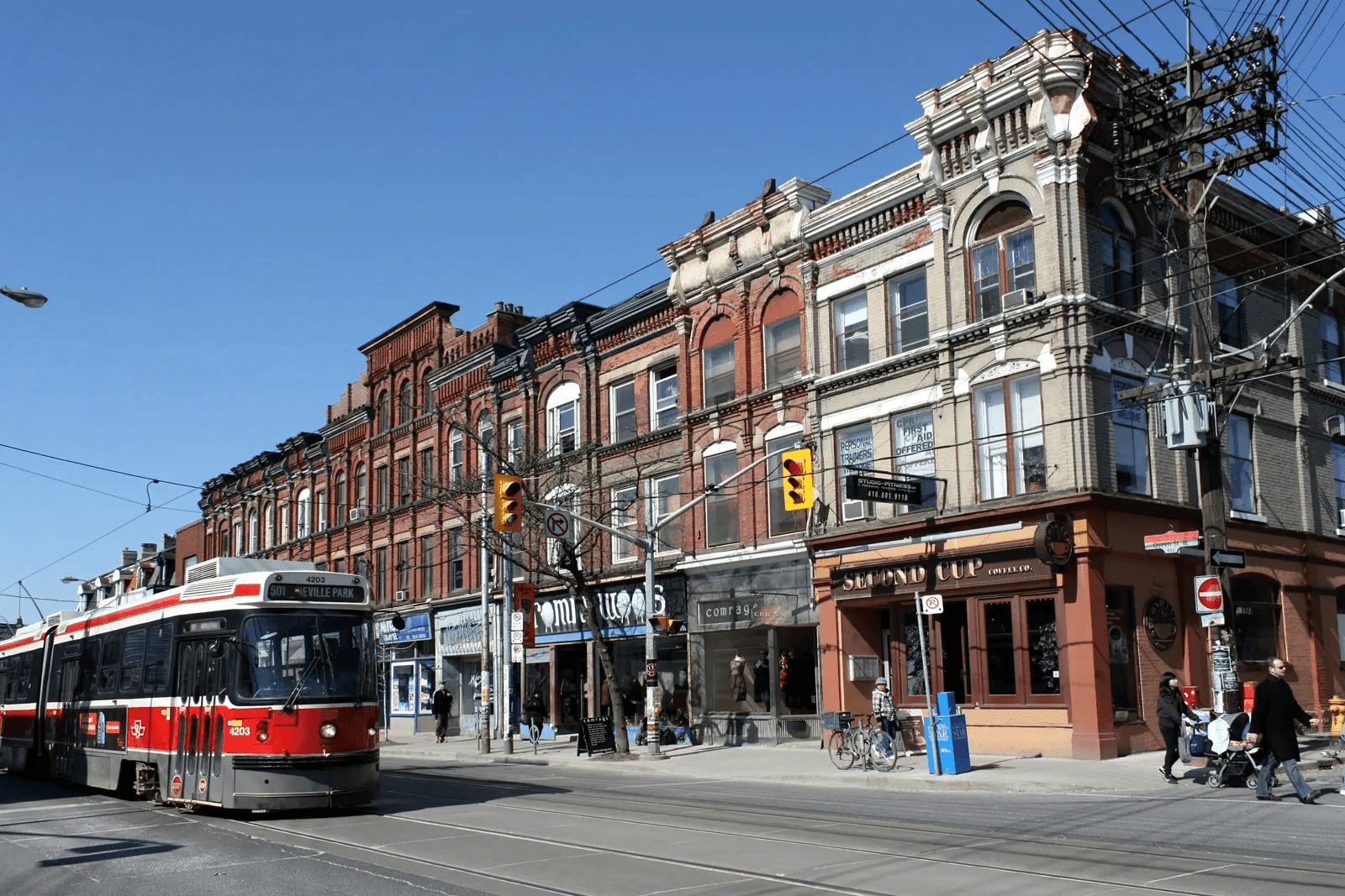
Additionally, the city lies at the edge of some of Canada’s best agricultural land, with a climate suitable for growing a wide variety of crops, making Toronto a transportation, distribution, and manufacturing hub. Most importantly, its location creates highly favourable economic ties with the United States. Since the second half of the 20th century, Toronto has experienced phenomenal growth, evolving from a relatively quiet provincial town into a bustling, prosperous, cosmopolitan metropolitan area. Today, the city covers an area of 244 square miles (632 square kilometres).
The city’s climate
Toronto experiences a continental climate significantly influenced by its proximity to the Great Lakes. The average January temperature ranges from the low to mid-20s °F (-4.2 °C), though cold winds typical for Toronto can drastically lower this temperature. In summer (mid-July), temperatures usually hover around 70 °F (22.2 °C); however, there are days when temperatures exceed 90 °F (32 °C) with 100% humidity, a common occurrence for the city.
Westerly winds prevail, and precipitation levels, affected by the Great Lakes, average about 33 inches (834 mm) annually, distributed evenly throughout the year. During winter, this precipitation primarily falls as snow, totalling more than 4 feet (131 cm). Latitude plays a significant role in Toronto’s relatively mild climate and the fertile farmland of southern Ontario; the city is located at 43° 40′ N. However, extreme weather events occasionally impact Toronto. For example, Hurricane Hazel in 1954 caused approximately $1 billion CAD in damages (adjusted for today’s value) and claimed 81 lives.
In addition to snowstorms, ice storms, strong rainfalls, and downpours, tornadoes are rare but can occur, especially in Toronto’s northern and western suburbs. The area is located at the northeastern edge of “Tornado Alley,” where tornadoes occur most frequently in Canada. Downtown Toronto typically avoids severe storms thanks to lake breezes that hinder storm formation. Tornado warnings were issued several times in the early 21st century, but no touchdowns have been confirmed within Toronto since a weak tornado hit Scarborough in 1998. In neighbouring Vaughan, a pair of F2 tornadoes touched down during the August 20, 2009, outbreak.
Toronto’s position on Lake Ontario’s northwestern shore spares it from the heavy lake-effect snowfalls that hit other Great Lakes cities on the southeastern shores. Nonetheless, two or more significant snowfalls occur each winter, accumulating at least 15 cm (5.91 inches), usually from powerful winter storms like Alberta clippers or Colorado lows. These storms pick up moisture en route to the Great Lakes, often bringing a mix of snow, sleet, freezing rain, and rain, disrupting transportation and causing power outages. For instance, a prolonged ice storm on December 22, 2013, left 30% of the city without power, with some areas in darkness until Christmas.
Summertime high temperatures typically range from 23 to 31 °C (73 to 88 °F) with moderate to high humidity. Proximity to Lake Ontario and other water bodies raises humidity levels during summer, influenced by distant sources like the Gulf of Mexico. Cooling from the lake varies depending on location, wind direction, water temperatures, and weather patterns. The effect is most pronounced near Toronto Islands and along the lakeshore but less noticeable in the western and northwestern parts of the city.
The impact of water bodies on the Toronto region’s landscape
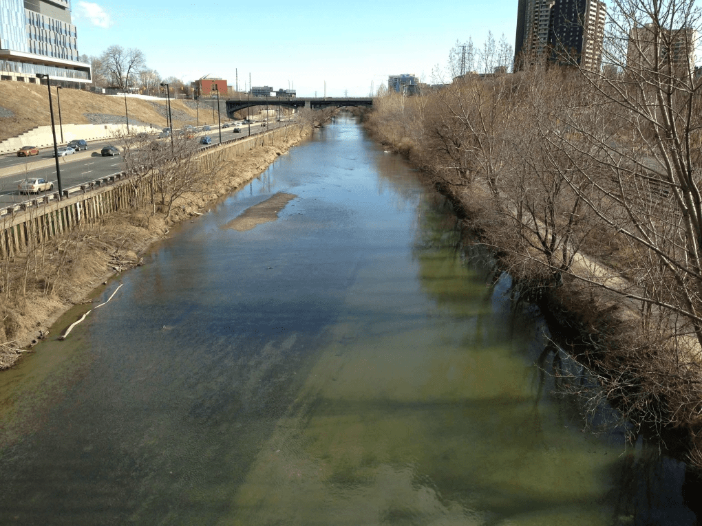
Glacial melting during the last Ice Age profoundly reshaped Toronto’s landscape. About 11,000 years ago, a much larger lake—glacial Lake Iroquois—covered the area, sitting roughly 130 feet (40 metres) above the current Lake Ontario level. With the opening of the St. Lawrence River, the lake’s water levels dropped more than 300 feet (90 metres) below current levels before gradually rising to today’s level, leaving behind a marshy shoreline and a natural harbour. Toronto’s location is largely flat, though 3–4 miles (5–6 km) inland, there’s a sharp rise of about 40 feet (12 metres), marking the shoreline of the former glacial lake.

The surrounding land’s resources significantly contributed to Toronto’s development. Rich sedimentary soils in southern Ontario created excellent farmland, while ancient Canadian Shield rock to the north provided valuable mineral resources and extensive forests of spruce and pine. Toronto’s location at the Humber River’s mouth also facilitated a trade route to Lake Simcoe, shortening the path to Georgian Bay on Lake Huron.
The influence of natural conditions and resources on residents’ health
With Toronto’s growing population (largely due to immigration), the city faced numerous health challenges. In 1883, the city appointed its first health officer to combat infectious diseases (such as smallpox) and raise public awareness of sanitation and disease prevention. Like many industrial cities, Toronto grappled with poverty. Residents in slums suffered from poor nutrition, inadequate water quality, and polluted air.
Waste collection and sorting began in the 1830s. By the 1870s, a public water supply system was in place (though not universally available), and major sewer lines were established by 1900. However, sewage was discharged into Lake Ontario along with industrial waste, while the lakeshore supplied drinking water. In the early 1900s, sewage and water treatment facilities were introduced, and over time, Torontonians improved them.