

Park · Toronto · ⭐ 9.5/10 · 3834 reviews · updated: 2026-08-03 23:54:26
Address: 7277 14th Ave, Markham, ON L6B 1A8, Canada
Rouge National Urban Park — the first national urban park in Canada, and the largest of its kind in North America
Seventy-nine square kilometres of river valley, Carolinian forest, wetland, beach and working farmland, all of it inside the Greater Toronto Area and all of it free to enter. Rouge National Urban Park is not a big city park; it is a national park with a subway-and-bus commute, created by its own act of Parliament and run by Parks Canada, holding more than 1,700 recorded species of plants, animals and fungi within reach of several million people. It contains a 17th-century Indigenous village site, a two-hundred-year-old logging road, farms that have been worked continuously for generations, one of the last significant marshes on the Toronto waterfront, a Lake Ontario beach and the only campground inside the city limits. Almost nothing about it is typical, starting with the fact that a Toronto transit fare will put you at a trailhead.
Highlights
- The Mast Trail — 2.5 kilometres one way, rated moderate to difficult, and the park’s signature hike. It follows a logging route roughly two centuries old, cut when settlers felled the valley’s tall, straight white pines, floated the logs down the Rouge River to Lake Ontario and shipped them down the St. Lawrence and across the Atlantic to be turned into masts for the Royal Navy.
- Bead Hill National Historic Site — the archaeological remains of Ganatsekwyagon, an intact 17th-century Seneca village, designated a National Historic Site in 1991, with evidence of human presence on the site going back some 3,000 years. It is a protected archaeological site rather than a visitor attraction, and it is not open for public access.
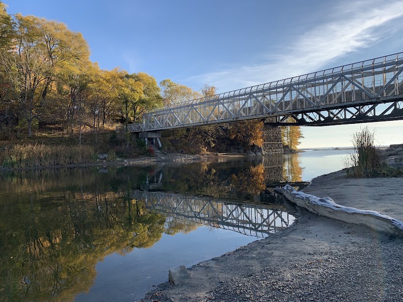
- Rouge Beach and the Rouge Marsh — roughly a kilometre and a half of Lake Ontario shoreline at the river mouth, backed by one of the largest surviving wetlands anywhere on the Toronto waterfront, and a magnet for waterfowl, herons and migrating birds.
- The working farms — active, commercially farmed fields inside a national park, some of them cultivated by the same families for generations. Very few national parks anywhere protect farmland as a living cultural landscape rather than restoring it to wilderness.
- The Toronto Carrying-Place Trail — the portage route that linked Lake Ontario to Lake Simcoe and the upper Great Lakes, in use for centuries before European arrival and designated a National Historic Event in 1969. The Rouge valley was one of its principal corridors.
- The species count — over 1,700 species recorded, including 1,006 plants (six of them nationally rare), 261 birds, 65 fish, 40 mammals and 21 reptiles and amphibians. Parks Canada has reared and released well over a hundred young Blanding’s turtles here since 2014 to rebuild a threatened population.
What you’ll find
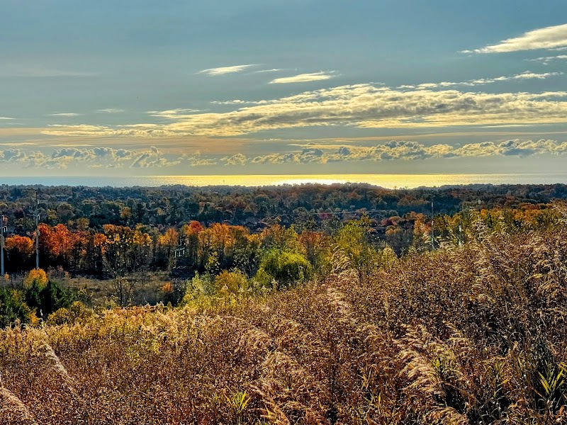
The park runs north from Lake Ontario deep into the countryside, crossing five municipalities, so its character changes completely along its length: beach and marsh at the bottom, deep forested ravine in the middle, open farmland and meadow at the top.
- More than a dozen named and signed trails, from the 600-metre Glen Eagles Vista spur to the 10.7-kilometre Northeast Trail, with the Vista, Orchard, Cedar, Woodland, Monarch, Tallgrass and Central trails covering everything between.
- Rouge Beach on Lake Ontario, with day-use parking, plus the marsh boardwalk area at the river mouth.
- Glen Rouge Campground — the only campground within Toronto’s boundaries, though it has been closed for a long-term programme of upgrades and repairs.
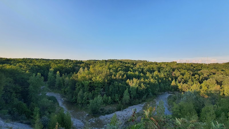
- The Rouge River and Little Rouge Creek carving steep, forested ravines through the middle of the park.
- Carolinian forest at close to the northern limit of its range in Canada, alongside meadow, tallgrass and wetland habitats.
- The Toronto Zoo, which sits at the park’s western edge and shares access roads and trailheads with it — a separate paid attraction, but a natural pairing for a full day.
Things to do — and who it’s for
- Hikers — the only place in the region where you can walk a genuinely rugged ravine trail, an open farm road and a lakeshore in the same outing, all on marked and maintained routes.
- Birdwatchers — 261 recorded bird species, with the marsh and river mouth concentrating waterfowl and migrants in spring and autumn.
- Families — short, easy trails such as Glen Eagles Vista and the beach make it workable with small children, and Parks Canada runs guided and educational programming through the season.
- History travellers — a National Historic Site, a National Historic Event and a two-century-old logging road, all within one park boundary.
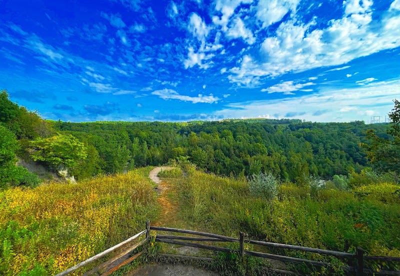
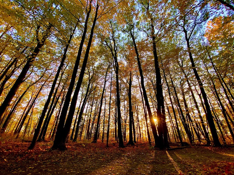
- Photographers — ravine forest in October, ice-fringed river in January, marsh at dawn and open farmland under summer storm light are four completely different subjects in one place.
- City dwellers without a car — this is the rare national park you can reach on public transit, which makes it a genuine option for anyone in Toronto with a free morning.
Getting there & practical
The park spreads across the eastern edge of Toronto — Scarborough — and north into Markham, Pickering, Uxbridge and Whitchurch-Stouffville, so there is no single entrance. For the lakeshore end, GO Transit’s Lakeshore East line stops at Rouge Hill station, only minutes on foot from Rouge Beach and the marsh. For the central trails and the Toronto Zoo area, take Line 2 Bloor–Danforth to Kennedy station and the 86 Scarborough bus, or the 54 Lawrence East bus, both of which serve the zoo; the 85 Sheppard East and 116 Morningside routes reach other edges of the park. Admission is free and the park is open 365 days a year — unusual for a Canadian national park — though parking is charged at the Zoo Road day-use area, and beach and lot hours are seasonal, typically opening around seven in the morning and closing in the evening. Allow two hours for a single trail such as the Mast Trail loop, half a day for the beach and marsh together, and a full day if you combine trails at different ends of the park. Bring water and proper footwear: the ravine trails have real elevation change, roots and mud, and services inside the park are minimal.
When to visit
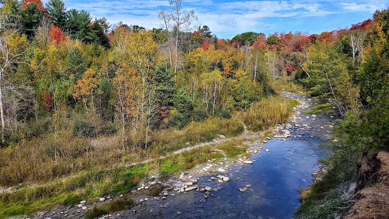
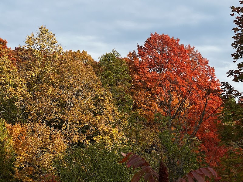
Spring is the birding season and the wildflower season at once — the marsh fills with returning waterfowl, the forest floor greens up before the canopy closes, and the trails are quiet if muddy. Summer brings the beach into play, the farm fields into full growth, and warm-weather programming from Parks Canada, though the ravine trails stay shaded and cool even in a Toronto heatwave. Autumn is the best single reason to come: the Carolinian hardwoods turn hard yellow and red through the ravines, the crowds thin after Labour Day, and salmon push up the river from Lake Ontario, which is a genuine spectacle at the right spots. Winter is when the park is at its emptiest and, for many regulars, its best — snow holds on the forest floor, animal tracks read like a printed record across it, the marsh and river edges freeze into ice sculpture, and a clear cold morning on a ravine trail is one of the few genuinely wild experiences available inside a Canadian city. Trails are not all cleared, so proper boots and layers matter, and daylight is short.
Good to know
Rouge is a legislative first. The Rouge National Urban Park Act, introduced as Bill C-40, came into force on 15 May 2015, creating a category of protected area that had not previously existed in Canada — a national urban park, administered by Parks Canada under its own statute rather than as a conventional national park or a provincial conservation area. Assembling it took years of land transfers from federal, provincial and municipal owners; by 15 June 2019 roughly 95 per cent of the 79.1 square kilometres was under Parks Canada management. The land itself has a far deeper record. Bead Hill preserves the remains of Ganatsekwyagon, a Seneca village occupied in the seventeenth century, and archaeological evidence at the site extends back roughly three thousand years; it was designated a National Historic Site in 1991 and remains protected and closed to public access. The valley formed part of the Toronto Carrying-Place Trail, the portage corridor between Lake Ontario and Lake Simcoe that carried people and trade goods north for centuries and was recognized as a National Historic Event in 1969. In the nineteenth century European settlers logged the valley’s white pines — tall, straight, and ideal for ship masts — floating them down the Rouge to the lake and onward to Britain, and the Mast Trail still follows the road they cut. Farming came next and never stopped, which is why the park protects working agricultural land as part of its mandate. Conservation work today is concrete and ongoing: Parks Canada has released well over a hundred head-started Blanding’s turtles into the wetlands since 2014, and the park now records more than 1,700 species overall. The long-term ambition is a continuous protected corridor and trail system running from the Lake Ontario shoreline all the way north to the Oak Ridges Moraine.
Visitor tips
- Pick your end of the park before you set out — the lakeshore and the northern farmland are a long way apart, share no trail connection at present, and are reached by completely different transit routes.
- The Mast Trail is rated moderate to difficult for a reason: it is a genuine ravine hike with climbs, roots and mud after rain, so wear boots rather than street shoes and allow more time than the 2.5-kilometre length suggests.
- Check trail and facility status before travelling. Sections close for restoration and flood damage, the Rouge Marsh Trail has been shut, and Glen Rouge Campground has been closed for a long-term upgrade programme.
Questions & answers
Does Rouge National Urban Park charge admission? No. Entry is free and the park is open every day of the year, which sets it apart from most Canadian national parks. Parking at the Zoo Road day-use area is paid, and some lots operate on seasonal hours.
What makes it a “national urban park”? It was created under its own legislation, the Rouge National Urban Park Act, which came into force on 15 May 2015 — the first protected area of this type in Canada. It is run by Parks Canada, but it sits inside a metropolitan area and protects farmland and cultural landscapes alongside nature.
How large is it and where does it reach? About 79.1 square kilometres, roughly 19,500 acres, extending from the Lake Ontario shoreline in Scarborough north through Markham, Pickering, Uxbridge and Whitchurch-Stouffville.
Can I get there by public transit? Yes, and that is part of the point. GO Transit’s Lakeshore East line serves Rouge Hill station near the beach, and TTC buses including the 86 Scarborough and 54 Lawrence East reach the zoo area and central trailheads from Line 2 Bloor–Danforth.
Which trail should a first-time visitor do? The Mast Trail, 2.5 kilometres one way, for the combination of Carolinian forest and two centuries of logging history. For an easier introduction, the 600-metre Glen Eagles Vista or the 1.5-kilometre Vista Trail take far less effort.
Is there really a beach? Yes. Rouge Beach runs roughly a kilometre and a half along Lake Ontario at the mouth of the Rouge River, with the Rouge Marsh — one of the largest remaining wetlands on the Toronto waterfront — directly behind it.
Can I camp in the park? Glen Rouge Campground is the only campground inside Toronto’s boundaries, but it has been closed for a long-term programme of upgrades and repairs, so check its status before planning an overnight stay.
What wildlife might I see? The park records more than 1,700 species in total, including 261 birds, 40 mammals, 65 fish and 21 reptiles and amphibians. Deer, coyote and a large range of birdlife are common sightings; Blanding’s turtles, a threatened species, are being actively reintroduced.
Is the Seneca village site open to visitors? No. Bead Hill, the remains of the 17th-century village of Ganatsekwyagon, was designated a National Historic Site in 1991 and is a protected archaeological site closed to public access.
Photos
Show 1 more photos
Visitor reviews
Reviews last updated: 2026-08-03 23:54:26
Data is refreshed monthly. Sources: toronto.name and editorial picks based on reviews.
The park boasts a diverse landscape, including lush forests, quiet meadows, wetlands, and the Rouge River. I hiked the two trails, Vista & Mast, which offer scenic views and natural beauty. You can enjoy birdwatching, ca…
Couldn't explore much of it in one visit as there's so much to trail if one wants to. But the visitor guide staff was very helpful and parking was free so that's a plus. Not sure for how long they keep it free though. En…
This national park is located near the Toronto Zoo. It's a quiet and pleasant place for a leisurely hike or bike ride without going too far out of the city; a great spot to escape the city while still inside the city. A…