While there are many different stories about Toronto, the tale of the city’s islands is one of the most fascinating and inspiring. The Toronto Islands were not always solid landmasses; in fact, they began as a series of ever-shifting sandbars, or littoral drift deposits, that originated from the Scarborough Bluffs and were carried westward by the currents of Lake Ontario. By the early 1800s, the longest of these sandbars stretched nearly nine kilometres southwest from what is now Woodbine Avenue, across Ashbridge’s Bay and the marshes of the lower Don River, forming a natural harbour between the lake and the mainland. Read more at toronto.name.
The First Inhabitants: Life and Livelihoods on the Islands
The Toronto Islands are the traditional territories of the Wyandotte, the Mississaugas of the New Credit First Nations, the Haudenosaunee Confederacy, the Anishnabek Nation, and the Métis Nation. These peoples have lived in the territory of Canada for at least 12,000 years.
The Wyandotte, meaning “the Island People,” were a confederacy of four Iroquoian-speaking nations. In the 15th century, they inhabited the Toronto area, which extended north to Lake Simcoe and Georgian Bay. The Wyandotte lived in longhouses within villages that housed hundreds or even thousands of people. These villages were strategically located, usually on slightly elevated ground, near reliable water sources and fertile soil for farming. The Wyandotte were known for their agricultural skills, and their communities were largely sustained by cultivating the “Three Sisters”: corn, squash, and beans. They also engaged in hunting, fishing, and gathering wild plants. Their villages were relocated every 10 to 30 years as the soil and wood supplies became depleted.
French explorers arrived in the region in the early 17th century and gave the Wyandotte people the nickname “Huron,” a derogatory term derived from the French word for “boar’s head.” They were likely referring to the central strip of hair worn by the men of this nation. The French and other Europeans exchanged knowledge, goods, and services with them. Unfortunately, the Europeans also brought many diseases, such as smallpox, tuberculosis, and influenza. These illnesses devastated the Wyandotte and other Indigenous populations. Subsequent wars further reduced their numbers, eventually leading to their displacement.
Two nations of the Haudenosaunee Confederacy, who were also Iroquoian-speaking, settled in the Toronto area in the 17th century after the dispersal of the Wyandotte. The name Haudenosaunee means “People of the Longhouse.” They are also known as the Iroquois, but this name is incorrect as it was given to them by their enemies. This offensive nickname comes from the term “Irok,” meaning “rattlesnakes,” to which the French added the suffix “-ois.” The two Haudenosaunee nations that moved to Toronto were the Kahniakenhaka, “the People of the Flint” (also known as the Mohawk), and the Onondowagah, “the People of the Great Hill” (also known as the Seneca). The Kahniakenhaka and Onondowagah lived in Teiaiagon, a large village on the east bank of the Humber River. Teiaiagon was a major settlement with a population of over 5,000 people. The people favoured the village’s location because the Humber River had become a vital trade route between Lake Ontario and Lake Simcoe. Today, this route along the Humber River is known as the “Carrying Place Trail.”
Incidentally, in the Kahniakenhaka language, the word “Tkaronto” means “the place where trees stand in the water.” This referred to an area where the Wyandotte people drove stakes into the water to create fishing weirs between Lake Simcoe and Lake Couchiching. It wasn’t until the late 18th century that the name Toronto became associated with the area that the city now occupies. The Mississaugas, part of the Anishinabek Nation, moved into the Toronto region after the Seneca in the late 17th century. At that time, the Mississauga people did not practice agriculture; they were hunters and gatherers. They lived in seasonal settlements, travelling throughout their territories to utilize different resources during the year.
It was during this period that the British began to actively strengthen their influence in the Toronto area (the French and British were at war in Europe and North America, a conflict that continued into the 18th century). The French presence in the Toronto region had led to the building of alliances with various Indigenous groups through diplomacy, trade, gifts, and personal relationships. The Mississauga and Haudenosaunee peoples, among others, were drawn into the European conflict, which ended with the British displacing the French from the Toronto territory. It is also known that after the French fled to Montreal, the British began negotiations with the Mississauga people for the Toronto territory.
The Agreement for the Land
In the early 1760s, the British and the Mississauga people established a relationship. Although their interactions became mutually beneficial and, so to speak, manageable, there was still underlying tension. For about two decades, they coexisted, trading and maintaining an alliance during conflicts with the Americans. In 1787, an agreement called the “Toronto Purchase” was signed. It concerned the “sale of Toronto.” The British believed that the Mississauga people had signed an agreement to surrender their rights to 250,888 acres of land in exchange for various goods valued at approximately £1,700. In turn, the inhabitants viewed this agreement as a pact for shared land use. It was common practice for Europeans to give goods to the Mississauga people as symbols of “peace and friendship.” Treaties for land settlement had never been made before.
The legality of this purchase is questionable, as the boundaries of the agreement were unclear, and the three Mississauga chiefs who made the deal did not sign the purchase document itself, but only separate sheets of paper that were attached to the deed. In 1805, the British arranged a second Toronto Purchase agreement, likely sensing that the first treaty was invalid.
It is important to note that the two parties had very different understandings and methods of recording such agreements, which led to confusion and unfair treatment in the future. The three Mississauga chiefs who had signed the original treaty had since passed away, and their people had no written record of the first agreement. This is why the British drafted a new document that included a much larger area than the 1787 agreement and presented it to the Mississauga people, whose land use was already restricted. The 1805 Toronto Purchase was paid for with just 10 shillings (or $60 Canadian dollars). The Toronto Islands were not part of the written agreement and are sacred lands for the Mississauga people and other First Nations. In 2010, the Government of Canada settled a land claim that was initiated in 1986 regarding the Toronto Purchase. The bulk of the $145 million compensation was placed in a trust for the community, but under the agreement, each adult member of the community received $20,000.
Why the Islands Led to Toronto Being Chosen as the Capital of Upper Canada, and How They Were Formed
During the British colonization, John Graves Simcoe became the first Lieutenant-Governor of Upper Canada. He chose Toronto as the capital of Upper Canada for several reasons: the location was easily accessible by the most common mode of transport—water—and it was easily defensible thanks to the Toronto Islands (then a sand spit/peninsula) which protected the harbour and surrounded the territory. In 1794, the British began constructing storehouses and a guardhouse.
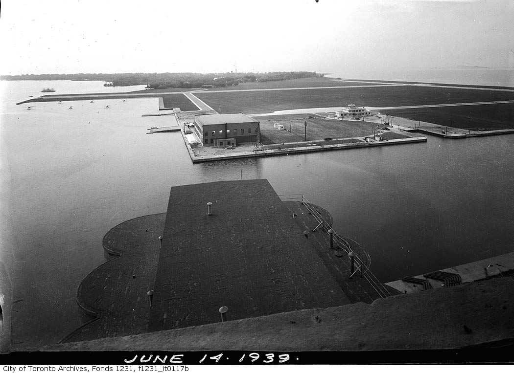
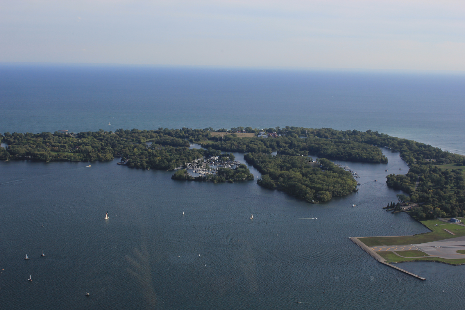
In 1850, a young engineer named Sandford Fleming studied the movement of the sand spit and calculated that twelve hectares had been added to its western end over the previous fifty years. In the early 21st century, a series of powerful storms and strong wave action began to erode the peninsula, requiring frequent repairs of small breaches. Finally, in 1858, a storm completely separated the peninsula from the mainland, and the gap was not repaired. This is how the island was born. The Eastern Gap has since become a vital shipping route to the Toronto Harbour. Dredging projects were aimed at stabilizing the shoreline, reducing the movement of sandbars, creating deeper channels for boats, or generally raising the land level.
The Creation and Expansion of the Islands
In 1904-1906, a channel was cut north of the Islands Filtration Plant, along Hiawatha Avenue. In 1909, Long Pond was dredged to replace the regatta course previously located at Hanlan’s Point. The resulting material was used to expand Mugg’s Island. Through similar projects, Olympic Island was created. High lake levels continuously caused damage to the islands, so on January 1, 1956, the City of Toronto transferred responsibility for the islands to the Municipality of Metropolitan Toronto (Metro) to develop the area as a regional park.