

Rapid urban growth and the realities of global climate change are presenting modern metropolises with unprecedented challenges. For coastal and waterfront cities, flooding remains one of the greatest threats. Situated on the shores of Lake Ontario, Toronto spent decades living under the shadow of a catastrophic flood risk across its southeastern districts. To tackle this challenge head-on, Canadian engineers and urban planners launched one of the world’s most ambitious infrastructure initiatives: the $1.4-billion Port Lands Flood Protection Project. This isn’t just about pouring concrete or building a standard seawall. As toronto.name reports, this massive undertaking is carving out a brand-new river valley from scratch, remediating millions of tonnes of toxic soil, and transforming an industrial wasteland into a vibrant waterfront oasis.
A Historic Blunder and a Looming Threat over the City
To truly appreciate the scale of the Port Lands Flood Protection Project, you have to look back 150 years. The mouth of the Don River was once one of the largest freshwater wetland ecosystems in the Great Lakes region. Rich in fish, birdlife, and diverse vegetation, this unique marshland served as a vital gathering place for Indigenous peoples for millennia.
Everything changed in the late 19th century. Driven by an industrial boom, city officials dismissed the wetlands as a waste of valuable space. Over the following decades, this delicate ecosystem was buried under infill and industrial waste to create the Port Lands—an artificial industrial zone dedicated to factories, shipping docks, and warehouses. Meanwhile, the Don River was forced into the Keating Channel, a narrow concrete strait that required the water to make an unnatural, sharp 90-degree turn before emptying into the lake.
This design choice became an environmental time bomb. Without its natural floodplain, the Don River grew into a permanent threat to the city. During extreme rainstorms or weather events matching the devastation of Hurricane Hazel in 1954, the concrete channel simply couldn’t handle the volume. More than 290 hectares of urban land—including South Riverdale, Leslieville, and the eastern edge of downtown—faced the threat of severe flooding. For decades, this massive liability effectively paralyzed any major redevelopment along the waterfront.
A Radical Solution: Giving the River Back Its Flow
In 2017, Waterfront Toronto—a consortium backed by federal, provincial, and municipal governments—embarked on a massive effort to undo the mistakes of the past. The master concept was designed by the world-renowned landscape architecture firm Michael Van Valkenburgh Associates Inc. (MVVA).
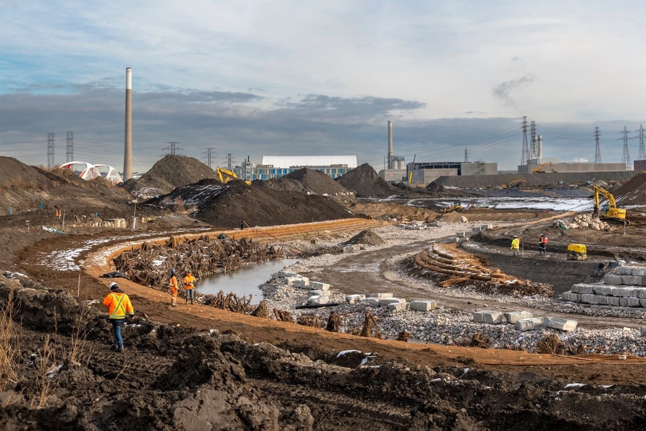
Instead of relying on conventional concrete dikes, engineers and environmental scientists chose naturalization. They decided to carve out a completely new, meandering 1,000-metre riverbed for the Don River. Featuring natural curves, wetlands, and floodplains, this new valley is engineered to absorb excess water during major storms and safely route it out to Lake Ontario, keeping the city dry.
Four Dimensions of an Engineering Marvel
The Port Lands Flood Protection Project is a complex puzzle of 23 interconnected engineering and ecological sub-projects, which can be broken down into four key pillars:
- Earthworks and Ecological Protection
- A New River Valley: The banks of the new riverbed are fortified with living systems rather than concrete. Using bioengineering methods, crews integrated tree roots, coir logs, and stones that have since filled in with grass and shrubs, creating a robust, natural defense against erosion.
- The Don Greenway: This dedicated green corridor acts as a tranquil wetland under normal conditions, but serves as a crucial secondary spillway during extreme floods, safely diverting high waters toward the Ship Channel.
- Cleaning Up an Industrial Legacy: Because the Port Lands hosted heavy industry for over a century, the ground was severely contaminated. Experts from WSP and their partners tackled a monumental cleanup, removing, treating, or safely encapsulating more than 1,000,000 cubic metres of toxic soil.
- Creating New Ecosystems and Parklands
The project has gifted Toronto 25 hectares of new public parkland. The crown jewel is Biidaasige Park, which seamlessly blends modern playgrounds, walking paths, ziplines, and sheltered coves perfect for kayaking. Landscape designers planted over two million herbaceous plants, 77,000 shrubs, and 5,000 trees, turning a former industrial dump into a thriving green oasis.

- Architectural Icons: The New Bridges
To connect these new waterfront grounds with the rest of the city, four striking, futuristic red-and-white bridges were installed, instantly claiming their spot as new Toronto landmarks:
- Two bridges on the newly aligned Cherry Street North (with one structured to accommodate a future transit line).
- The Cherry Street South bridge, spanning the river’s new mouth.
- The Commissioners Street bridge—a stunning, three-span structure stretching across the river valley.
- Infrastructure for the Future
Beyond the addition of dedicated transit lanes and bike paths, a state-of-the-art utility network was built deep underground. This includes a new stormwater management system and a pumping station that directs wastewater straight to the Ashbridges Bay Treatment Plant, ensuring long-term environmental safety for the entire area.
A Historic Milestone: The Birth of Ookwemin Minising
The project reached its most significant milestone in late 2024 with the removal of the “North Plug”—a massive temporary earthen dam that kept the Don River separated from its new channel during construction.
Once the plug was breached, river water flowed along its natural path for the first time in a century. This breakthrough marked the physical creation of a brand-new, roughly 40-hectare island.

In a symbolic move, Toronto City Council named the new landmass Ookwemin Minising, which translates to “place of the black cherries” in the Ojibwe language. The name pays tribute to the wild cherry orchards that flourished along these shores long before the dawn of industrialization.
Ecological Revival: Nature Reclaims Its Place
The Port Lands initiative serves as a textbook example of climate-positive urban design. It did more than just protect residents; it brought wilderness right back into the heart of Canada’s largest city:
- Natural Filtration: The wetlands and floodplains in the new valley act as the city’s natural kidneys, filtering urban stormwater runoff before it empties into Lake Ontario.
- Fish Habitats and Carp Gates: Specialized shallow wetlands were engineered along the banks to provide spawning grounds for native fish species. To safeguard these areas from aggressive, invasive Asian carp, specialized acoustic and physical carp gates were installed at the wetland entrances.
- Cooling the Urban Heat Island Effect: The massive influx of greenery at the foot of the river helps lower local air temperatures, offering relief during scorching summer heatwaves.
Looking Ahead: Canada’s First True Eco-District
Mitigating the flood risk has cleared the way for Toronto’s next great urban frontier. Ookwemin Minising is being planned as the country’s first fully net-zero, eco-friendly community.
The blueprint for the island includes:
- High-quality housing for 15,000 residents, with a heavy emphasis on affordable and co-op options.
- The creation of over 3,000 jobs right on the island.
- Cutting-edge green technology integration, featuring energy-efficient buildings, geothermal heating, and a layout that gives total priority to pedestrians, cyclists, and public transit.
All three levels of government have committed nearly another billion dollars to accelerate development on the island. Combined with massive surrounding developments—including the nearby Quayside community—the broader waterfront area will eventually home over 100,000 people. Economists project this massive development boom will inject more than $13.2 billion into the Canadian economy.
A Legacy to Last Generations
Canada’s national disaster mitigation guidelines indicate that every dollar invested in flood defense saves five dollars in emergency damages. The Port Lands Flood Protection Project has fully validated its price tag, insulating downtown Toronto from immense financial and humanitarian vulnerabilities in an age of climate unpredictability.
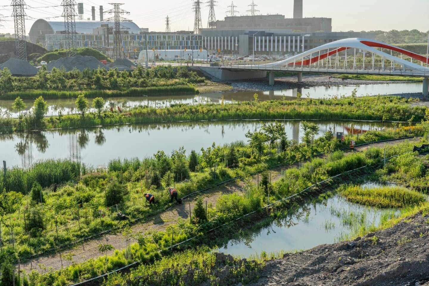
Yet, the project’s true victory lies in its human and ecological impact. The Port Lands transformation has proven on a global scale that solving modern climate dilemmas doesn’t always mean pouring more concrete and structural steel. The most effective engineering solutions of the 21st century are those designed to work in synergy with the natural environment. Today, the new bridges, the re-greened banks of the Don River, and the shores of Ookwemin Minising stand as powerful symbols of how a modern city can heal the wounds of its past to build a safer, more harmonious future.